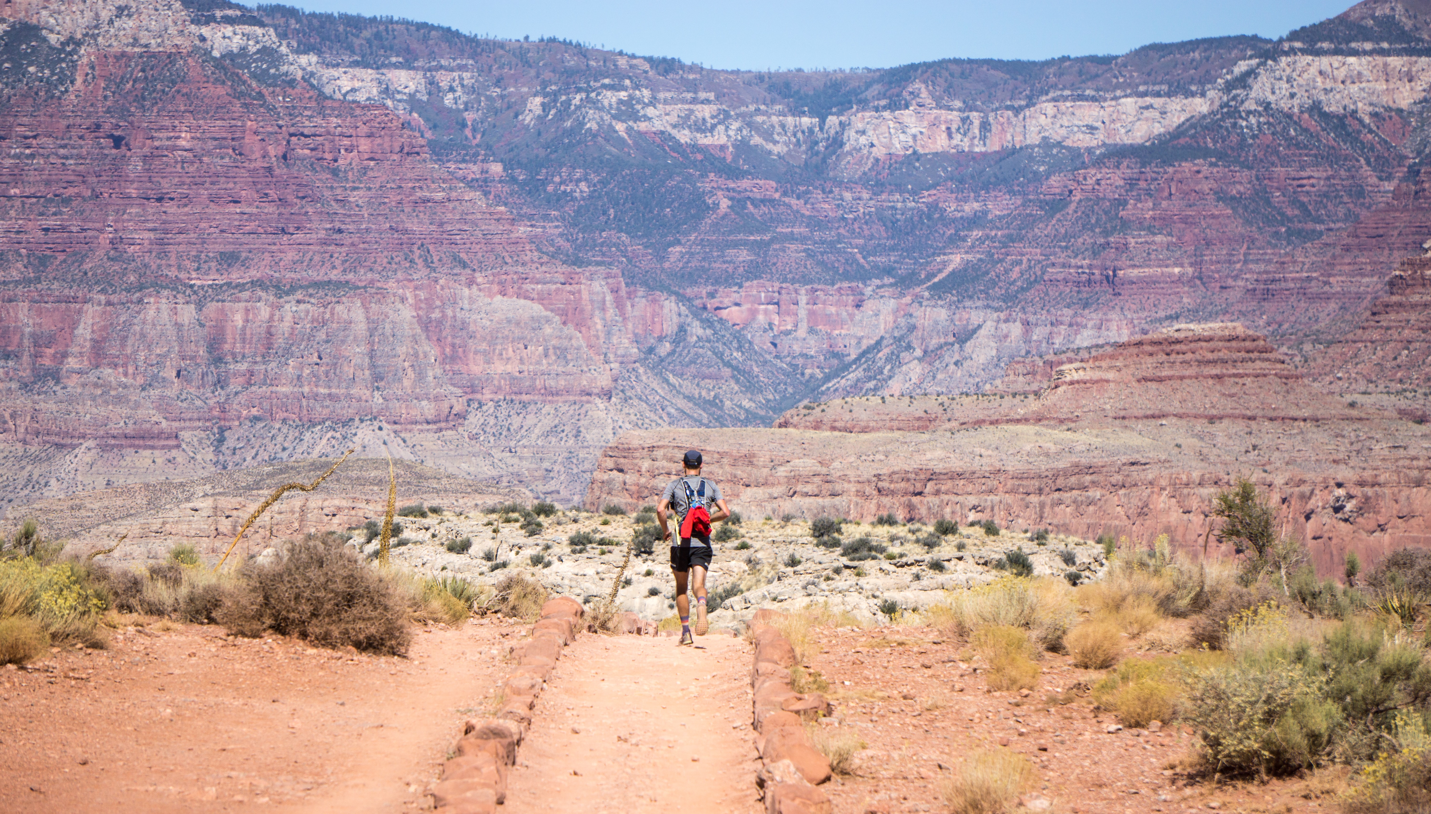
There’s nothing better to do in Tucson during the warm summer months than to spend time going hiking on the amazing hiking trails in the city. The beautiful weather and spectacular scenery that Tucson is known for is on full display throughout the myriad of picturesque hikes that can be found in the area.
Among the best destinations for hiking in Arizona is the Saguaro National Park, which is notable for being home to the largest cacti in the country. When you’re visiting this park to fulfill your hiking needs, you’ll notice that there are a wide range of trails situated throughout the park from low to high difficulty. With a high number of popular hiking trails available to you, it’s possible to choose one for the amazing scenery or to select another for the strenuous workout that it provides. If you’re thinking about taking a trip to the Saguaro National Park and want to prepare by jotting down a few trails to check out, the following provides a thorough guide to 11 of the best hiking trails in the Saguaro National Park.
11. Ridge View Trail (4.4 Rating)
Length: 2.3 miles
Difficulty: Moderate
The Ridge View Trail is a great hiking trail that’s perfect for anyone who enjoys spending time among nature. At 2.3 miles, it’s a relatively short trail that can be hiked at any time. This out-and-back trail begins and ends at the same place, which is an easy-to-spot trailhead that’s located at the end of the S. Camino Loma Alta Rd. There’s a spacious parking lot located a short distance from the trailhead, which usually has spots open. Because this trail is best known for its scenery, the best times to hike this trail would be during the spring and fall months. While there’s only 350 feet of elevation gain, it can get rocky towards the end, which is why it’s considered to be moderately difficult to hike.
You can find a detailed map of the trail here.
10. Hope Camp (4.3 Rating)
Length: 6.5 miles
Difficulty: Moderate
Hope Camp is a fantastic trail that’s open to horses and extends for just over 6.5 miles. While the trail is mainly used for hiking, it’s also a great place to go when you want to spot some local wildlife and plant-life. The flora in the area make for a very scenic hike as you pass numerous fields of bright yellow and pink flowers. With a 528-foot elevation gain, the hike can become somewhat difficult towards the end. If you come upon a part of the hike that’s too difficult, there are several great spots where you can relax and take in the scenery. For instance, you can dip your toes in the water around half way through at the Rincon Creek. The trailhead is the same as the Ridge View Trail at the end of the S. Camino Loma Alta Rd. For parking, there’s a spacious lot situated just before the trailhead.
You can find a detailed map of the trail here.
9. Tanque Verde Ridge Trail (4.5 Rating)
Length: 20 miles
Difficulty: High
The Tanque Verde Ridge Trail is a lengthy 20-mile trail that’s among the most difficult on this list. Due to its high difficulty, it’s only recommended for hikers who are highly experienced. It’s a great place for trail running and backpacking if you want to get in some strenuous exercise. However, there’s practically no shade along the way, which is why you must take several bottles of water. This is an out-and-back trail, which means that you can turn back at any time.
Nearly halfway through the trail, you’ll reach the picturesque Box Canyon river. The elevation gain is around 5,600 feet and can get very steep at times. While you’ll have an opportunity to spot many different types of wildlife, turtles are in abundance on this trail. To get to the trailhead, go south on Cactus Forest Dr. until you reach the end of the road, which is shortly after you pass the Freeman Homestead trailhead. There are several spots where you can park your car before you head out on the hike.
You can find a detailed map of the trail here.
8. Turkey Creek (4.3 Rating)
Length: 6 miles
Difficulty: Moderate
The Turkey Creek trail is a highly popular trail in the Saguaro National Park that extends for nearly six miles and is considered to be moderately difficult. Many experienced hikers find that this trail offers hikers the best opportunity to spot local wildlife. The trailhead can be found towards the end of Turkey Creek Rd. You’ll come upon a gate that offers access to a parking area with sizable sycamore trees. The beginning of the trail is on the other side of the creek.
This is a very scenic trail that offers plenty of opportunities for taking pictures even when the creek is dry. There’s also an ample amount of shade along the trail, which should keep you cool and comfortable. The final mile of this trail can be somewhat steep, which you should prepare for by wearing hiking shoes. Don’t forget to bring your dog with you as long as you keep them on a leash.
You can find a detailed map of the trail here.
7. Tanque Verde Falls Beach (4.6 Rating)
Length: 0.8 miles
Difficulty: Easy
The Tanque Verde Falls Beach trail is likely the easiest trail to hike on this list and is considered to be a nature trail. At just .8 miles long, even younger children should be able to hike this trail with ease. You can take your dog with you as long as you keep them on a leash. If you’re traveling south on Redington Rd., the trailhead can be found to your left, which is also where you’ll find a parking lot. The most notable element of this hike is the waterfall found at the very end, which opens up to a sizable pool with large rocks where you can sit and enjoy the scenery.
You can find a detailed map of the trail here.
6. Mica View Loop Trail (4.3 Rating)
Length: 3.7 miles
Difficulty: Easy
The Mica View Loop Trail is an easy yet somewhat lengthy 3.7-mile hiking trail on the edge of the Saguaro National Park that’s perfect for hikers of all skill levels. The trail is relatively open with minimal shade, which means that there are many opportunities for taking photos of expansive landscape but very few spots for shade. Throughout your hike, you’ll see plenty of wildflowers and local wildlife. The trailhead is located just off the E. Broadway Blvd. to the right, which is soon after you pass the North Avenida Aguila Rd.
You can find a detailed map of the trail here.
5. Garwood Trail (4.5 Rating)
Length: 3.3 miles
Difficulty: Easy
The Garwood Trail is a beautiful trail that’s considered to be easy to hike and great for admiring the scenery. The trail itself offers spectacular views of the nearby mountains and is lined with lovely creeks. This trail provides hikers with classic desert scenery along with fantastic opportunities for bird watching. When you’re trying to get to this 3.3-mile out-and-back trail, the trailhead is the same one as the Douglas Spring Trail, which is located right at the end of the East Speedway Blvd. Around .3 miles into the Douglas Spring Trail, you should notice a sign to your right that takes you down the remainder of the Garwood Trail.
You can find a detailed map of the trail here.
4. Loma Verde and Squeeze Pen Loop (4.5 Rating)
Length: 3.7 miles
Difficulty: Easy
The Loma Verde and Squeeze Pen Loop trail is a relatively short loop trail that extends for 3.7 miles and offers fantastic opportunities for bird watching as well as a variety of fun activities. There are many different wildflowers throughout this trail, which include such scenic flowers as the hedgehog cactus, the owl clover, and brittlebush. The trailhead can be found just off Cactus Forest Dr, which is also where you’ll find some parking spaces. While the hike itself is fairly easy, there’s practically no shade throughout the entirety of the hike, which is why you should take a substantial amount of water with you. The trail is accessible 24/7 and is open to dogs.
You can find a detailed map of the trail here.
3. Garwood Dam to Douglas Spring Loop Trail (4.4 Rating)
Length: 6.5 miles
Difficulty: Moderate
The Garwood Dam to Douglas Spring Loop Trail is a wonderful hiking trail that’s notable for the prevalence of wildflowers found throughout. The trail itself extends for 6.5 miles and is open all throughout the day. To get there, you will need to take the Douglas Spring trailhead at the end of the East Speedway Blvd. There are some parking spots just off the speedway that you can use if they aren’t full. Even though this loop trail is fairly lengthy, it isn’t that difficult and can be readily hiked by all skill levels. The best views occur while you’re in the foothills during the first half of the hike. Along with the cacti and wildflowers, it’s not uncommon to spot deer along the trail.
You can find a detailed map of the trail here.
2. Douglas Spring Trail (4.5 Rating)
Length: 16.6 miles
Difficulty: Moderate
The Douglas Spring Trail is among the most popular hiking trails in Arizona. When you want to visit the Douglas Spring Trail, you can get there by taking the East Speedway Blvd. until you reach a dead end. At this dead end is the trailhead that’s noted by a sign as well as a substantial amount of parking. This is an out-and-back trail, which means that it begins and ends at the same place. The trail is around 16.6 miles long, which means that you likely won’t be able to hike the entirety of it in a single day.
While horses are able to use the trail, dogs aren’t. The trail itself is known for the presence of the Sonoran Desert Scrub as well as the waterfall that’s found at the conclusion of the Bridal Wreath Falls trail. While the Bridal Wreath Falls marks the end of the hike for most people, you can continue past this spot for some spectacular views. The trail is moderately difficult but can be harder towards the end because of the 3,700-foot elevation gain.
You can find a detailed map of the trail here.
1. Bridal Wreath Falls Trail (4.4 Rating)
Length: 5.6 miles
Difficulty: Moderate
The Bridal Wreath Falls Trail is a beautiful out-and-back trail in the heart of the Saguaro National Park that features a pristine waterfall as well as many picturesque desert flowers. This 5.6-mile trail is moderately difficult, which means that you’ll want to use some good hiking shoes and bring an ample amount of water. While the first half of the hike is relatively simple and straightforward, the second half can get steep with an elevation gain of more than 1,000 feet. The waterfall at the end of the trail is considered to be the best feature of the hike.
The large rocks in the immediate vicinity of the waterfall are great for relaxing and having a quick bite to eat before you turn around for the second half of the hike. Keep in mind that dogs aren’t allowed on the trail. When you’re searching for the start of the trail, it’s important to remember that this trail is a part of the Douglas Springs trailhead, which is where you’ll need to go. This trailhead is clearly marked at the end of the East Speedway. The parking lot is sizable and should never be full when you’re looking for a place to park. The trail can be accessed at all times of the day.
You can find a detailed map of the trail here.
CONCLUSION
Tucson has a large variety of amazing hiking trails to go on these warm summer months! If you’re looking to move to this wonderful city, feel free to get in touch with our local team of Tucson real estate professionals at Grogan & Grogan Tucson Luxury Real Estate!